Feature · Interactive site boundary map
Draw the boundary. Pin the meter. Done.
Find the property on an interactive map, draw around its boundary and place the main cut-out fuse where it sits. CLRD turns it into the site boundary plan the DNO requires.
What it is
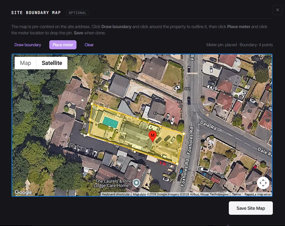
An interactive map built into the job. Find the property, draw around its boundary and drop a pin on the meter/cut-out. CLRD turns that into a clean site boundary plan and includes it in the DNO pack automatically.
Why it matters
Some DNOs will hold an application without one: SSEN put two General Type A applications on hold in September 2025 for a site plan showing the boundary with the meter point marked, and none of the applications that carried the plan was asked. CLRD marks it Required on a General Type A application and on an SGI-2 or SGI-3 to SP Energy Networks, and Recommended elsewhere. Done by hand that means screenshots, editing tools and a different look on every job. In CLRD it takes seconds, comes out the same on every pack, and always matches the address and details in the rest of the submission.
Ends the screenshot and scribble site plan forever.
- Draw the property boundary directly on the map.
- Place the meter/cut-out in its exact location.
- Generated as the site boundary plan in the DNO pack, automatically.
- The header states the pin as coordinates and as a what3words address.
- Consistent output on every job, whoever draws it.
 Enlarge
In practice
What changes on the next job.
Seconds, not screenshots
No paint tools, no map exports, no separate files.
Consistent every time
The same clean plan on every job, whoever runs it.
Always in agreement
Matches the address and details in the rest of the pack.
Before & after
With CLRD vs. without.
See interactive site boundary map on your own jobs.
A 20-minute demo with a real install, yours or ours.